New York City developers are working on plans to turn a parcel of land under the University Heights Bridge into a public space.
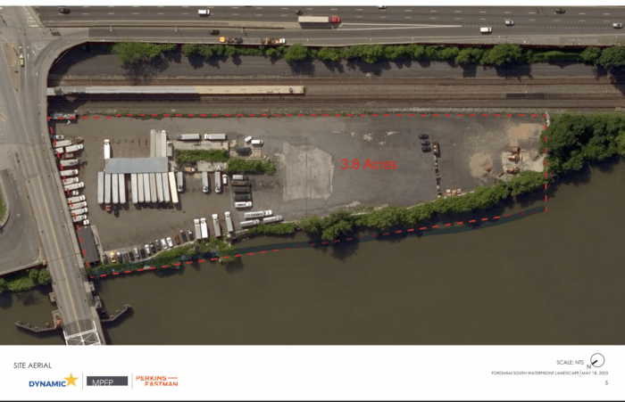
During Bronx Community Board 7’s executive committee meeting last Thursday night, officials from Dynamic Star — a real estate development, investment and marketing firm — presented their plans for a project they’re calling Fordham South, which would turn a privately owned 160,000-square-foot lot south of the University Heights Bridge into a two-level mixed-use residential and community open space. Along the Harlem River, the project would connect to the expressway on the north side and to Roberto Clemente State Park on the south.
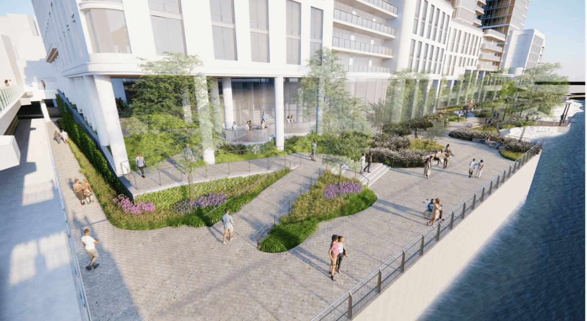
The site under the University Heights Bridge would be transformed into a public pavilion and walkway furnished with outdoor gym equipment, a small amphitheater, tables and chairs, benches and a garden. The design will create a new curb cut on West Fordham Road, across from the ramp down to Exterior Street — which has been “conditionally granted” by the New York City Department of Transportation, according to Lexi Glicksman, a public relations representative for Dynamic Star.
“Where we started, was thinking about the larger part of connectivity as a pedestrian and a biker and how you get to this open space,” said Rick Parisi, the owner and principal-in-charge of MPFP, a landscape architecture and urban design firm, and one of the leaders of the Fordham South project.
The public space will be built on two levels to accommodate both motorists coming from the roadways, as well as pedestrians and bikers. Developers said there will be approximately 290 parking spots for people if they want to drive to the site from other parts of the borough.
Parisi said his firm does quite a few public walkway designs as part of its regular contracted work.
“The shore public walkways are somewhat restrictive, but they do offer some interesting opportunities,” he said during the meeting. “In this particular one, we have more opportunities, I think, than most.”
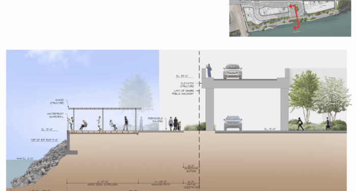
In conjunction with the New York City Department of City Planning, Parisi said his team has been able to capitalize on the space available “to really stretch it out and create a number of open spaces … on multiple levels.”
Glicksman told the Bronx Times that project plans are currently “under review by the appropriate city and state agencies.” She also confirmed that the site doesn’t need to be rezoned for the project.
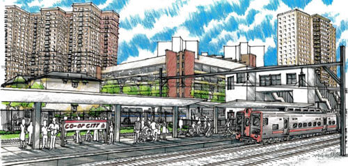
In a future phase of the project, called Fordham Landing South, developers also plan to build both a residential building and a 2,900-square-foot community facility near the University Heights Metro-North station entrance. The residential building, Glicksman said, will consist of 505 housing units — 30% of which will be affordable. Fordham Landing South is an as-of-right development, which means it already complies with all applicable zoning regulations.
While CB7 members were mostly supportive of the first phase of the project, some expressed concerns about the site of the pedestrian walkway and increased public access and traffic in the area.
Developers said they don’t anticipate any increased traffic or traffic delays as a result of the project, and that “the existing connections and ramps will be maintained.” In addition, they said they’re trying to approach this project from both “a traffic flow and a pedestrian flow point of view.”
CB7 board member Myrna Calderon said as a resident of the Fordham Hill area — just about a mile inland of the project site — she’s concerned the public walkway will be prone to flooding along the Harlem River. She said she recalled seeing the water level had risen “just short” of the Metro-North tracks during Hurricane Sandy.
Parisi said the design surpasses FEMA flood-mitigation regulations, placing pedestrians at 11 feet about above the median high-tide elevation.
Developers are now waiting for the approval for public waterfront access, as well as a transit easement from the City Planning Commission. In addition, the project is still pending approval from the Department of Buildings.
According to CB7 District Manager Karla Cabrera Carrera, this first phase of the project will not be going through the city’s Uniform Land Use Review Procedure, so CB7 won’t vote on it. But, she said, Dynamic Star is coming back to the board in June to present the next phase of the development.
Glicksman said once the project gets the green light, construction for the walkway is slated to start later this year and wrap up in 2026.
Correction: In a previous version of this story Lexi Glicksman was incorrectly titled the account executive for Dynamic Star. She is a PR representative for the firm.
Reach Camille Botello at cbotello@schnepsmedia.com. For more coverage, follow us on Twitter, Facebook and Instagram @bronxtimes