By Lawrence Lerner
Officials from New York City’s Department of City Planning held a much-anticipated three-hour public forum on Monday night, unveiling a revised Lower East Side and East Village rezoning plan in front of more than 200 people packed into Cooper Union’s Wollman Auditorium.
The meeting, which drew community activists, housing advocates, concerned
residents and staff of elected officials throughout the city, was an extension of a mid-October gathering at which City Planning representatives offered Community Board 3’s 197 Task Force a first glimpse of the draft proposal. Planning presented an identical plan this week, along with an analysis of soft sites — spots where future development is likely — included at the task force’s request.
Community Board 3 Chairperson Dave McWater presided over the forum, in which board members refrained from comment in order to allow an impassioned public to weigh in on an issue that has been at the center of community discussion for more than a year.
Mcwater started the meeting by saying the rezoning plan was 25 years in the making.
“The board has been trying to do this since the last rezoning, in 1961,” he said. “But community boards throughout the city are understaffed, and rezoning plans take a lot of time to complete. So, we came up with principles and asked City Planning to come up with a plan.”
Edith Hsu-Chen, deputy director of City Planning’s Manhattan Office, took the microphone after McWater and said the proposed rezoning achieves two major concerns of the community.
“We’ve implemented height limits, so you’ll no longer see the 20-to-26-story buildings that have been cropping up,” she said. “We’ve also included more inclusionary housing for low-income people.”
She then handed the reins over to Arthur Huh, Planning’s Community Board 3 liaison, who outlined the proposed plan during an hour-long presentation that was interrupted on a few occasions by bona-fide questions, along with a smattering of outbursts by audience members.
Huh began by putting the current zoning proposal into historical context, charting the shift from the “urban renewal and tower-in-the-sky” approach of the 1950s and ’60s, to the abandonment and disinvestment of the 1970s and ’80s, to the gradual reinvestment of the 1990s.
He said the existing zoning “represents a mismatch between the 1961 plan and the prevailing character of the area. Walking around,” he said, “it’s easy to appreciate the layout and human scale of the Lower East Side and East Village and the need for contextual zoning.” He outlined the proposed plan using maps and computer renderings of various buildings.
According to Huh, the proposed rezoning area encompasses 114 blocks and 2,856 zoning lots bounded by the north side of E. 13th St., the west side of Avenue D, the north side of E. Houston St., the west side of Pitt St., the north side of Delancey St., the east side of Essex St., the north side of Grand St., 100 feet in from the east side of the Bowery and 100 feet in from the west side of Third Ave.
Huh said that 75 percent of the area’s existing development is four to seven stories tall, although “below Houston St. is currently weighted toward exclusively commercial zoning. What we’re seeing here is a developing market for tall condos and hotels,” he noted.
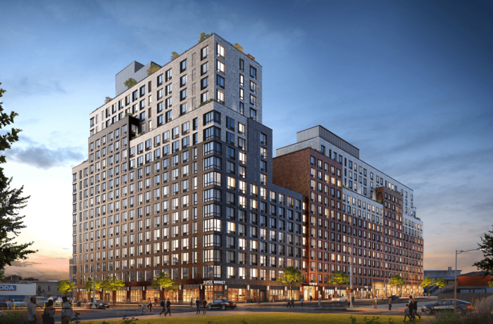
Under the proposed rezoning, the mostly residential, low-rise areas above Houston St. would change from R7-2 to R7-A zoning, requiring a floor-to-area ratio, or F.A.R., increase from 3.44 to 4.0. (F.A.R. is a formula used to determine how much bulk a building can have based on how much floor area it covers.) New construction would be capped at 80 feet and allow a street wall height of 40 to 65 feet with a setback above that, which means that new high-rise buildings of the height of Blue on Norfolk St., The Hotel on Rivington St. and the hotel by the Pomeranc group on Allen St. would no longer be allowed.
South of Houston St., where the zoning is predominately commercial, the F.A.R. would decrease from 6.0 to 4.0 as the zoning would shift from C6-1 to C4-4A. The 80-foot cap would also apply here.
In both areas, the community facilities F.A.R. — for building a dormitory or medical building, for example — would be lowered from 6.5 to 4.0 to bring it in line with the contextual zoning being supported by C.B. 3 and Planning. The ability to build higher by transferring air rights from adjacent properties would still be allowed, but only within the new height cap. This change would effectively end construction of buildings like New York University’s 26-story dorm on E. 12th St.
On larger corridors, such as the west side of Avenue D, E, Houston St., Delancey St. and the west side of Chrystie St., inclusionary zoning, or I.Z. for short, would enable a new building’s F.A.R. to be raised to 7.2 — to a maximum height of 120 feet — if 20 percent of the building’s units are set aside as affordable housing.
Those apartments would target families of four with an income equaling 80 percent of the area’s median income, or $56,720. Developers could additionally qualify for the city’s 421-A tax-abatement program by setting aside units for families at 60 percent of area median income, or $42,540.
Buildings on these wider corridors that don’t include affordable units would have a F.A.R. of 5.4, slightly larger than the residential F.A.R. of 4.0 that would be standard throughout the district.
During the post-presentation Q & A session, audience members asked questions and sounded off on a number of pertinent issues. While many applauded Planning’s new height caps, some argued they were insufficient.
“How do you justify an 80-foot height cap in an area with tenements only 40 feet tall?” asked Rob Hollander of Lower East Side Residents for Responsible Development. “This proposed plan doesn’t tell the story of the Lower East Side. There are virtually no buildings seven stories tall.”
Huh reiterated that he thought the proposed R7-A zoning met the criteria of contextual zoning.
“Our studies indicate this zoning is appropriate for the area,” he said.
Several audience members also took the city to task for leaving Third and Fourth Aves. out of the rezoning proposal and, therefore, ripe for development.
“Third and Fourth Aves. will be so-called corridors for development, as you say, but it seems to me that you’re using public-transportation access to justify big buildings,” said one irate participant. “These avenues are so congested already.”
“First of all, the development on those avenues is quite different from the areas included in our study area. It would only slow down the [rezoning plan’s] approval process to include them,” Hsu-Chen said.
“There’s also a land-use rationale for how City Planning determines opportunities for growth,” she added. “We look at a variety of factors, including soft sites, wide avenues that can accommodate development, access to good public transportation, institutional presence and other criteria.”
That didn’t stop Andrew Berman, executive director of the Greenwich Village Society for Historical Preservation, from asking, “Why not consider Third and Fourth Aves. in the current rezoning plan? Why consider it only as a separate plan? It feels like your setting us up now, only to turn us down later.”
Hsu-Chen held to her position, however. After the forum, she reiterated the difference between the avenues in question and the area under consideration, while debunking claims that City Planning was using public transit as an excuse for development.
“This is a fundamental tenet of urban planning, to direct growth at transit. We’re not looking at overgrowth. We’re looking to rezone judiciously,” she said.
The issue of commercial overlays on St. Mark’s Pl. also came up at the forum. McWater, C.B. 3’s 197 Task Force and many residents oppose the idea.
After the meeting, Hsu-Chen said that although the current R7-2 zoning on St. Mark’s Pl. prohibits commercial overlays, many older commercial establishments were grandfathered by the 1961 zoning.
“That’s partially how the ground or lower two floors of many buildings on that street became commercialized,” she said.
“We have to pull certificates of occupancy for all these businesses to see which ones are there illegally,” she added. “If the street is more than 50 percent legitimately commercial, then it’s reasonable to put a commercial overlay there. But we don’t have a clear picture yet — it’s too early to tell. Of course, since so many residents are against this because of noise and other issues, we’ll also want to take into consideration their wishes as we decide on this.”
Although a couple of participants criticized Planning for not having posted a map of soft sites on the agency’s Web site, Monday’s presentation included one on an overhead projector.
Hsu-Chen stressed that her agency uses standard criteria when analyzing such sites. Built floor area at an existing site has to be 50 percent or less of the maximum allowable floor area for the building to be considered ripe for development, for example. Libraries, schools, landmarked buildings, green spaces and parks and buildings with six or more rent-stabilized apartments are not considered soft sites.
“There will be fewer soft sites under the proposed rezoning plan, and this area will be less under threat for development,” Hsu-Chen said during the Q & A. Later, she added that “when we do an environmental review, we’ll present a more nuanced version of this analysis, but this is a very good picture of the situation.”
Hsu-Chen and Huh, along with officials from the city’s Department of Housing Preservation and Development, also answered questions on issues such as adding anti-harassment and anti-demolition clauses that many residents and Board 3 members want in the rezoning plan, as well as questions about affordable housing.
Hsu-Chen stressed that her agency is in the early stages of its community outreach process. An environmental impact study will follow starting in early 2007 and will take approximately six months to complete. By next fall, the proposed rezoning plan could be ready to be certified, after which the uniform land use review procedure, or ULURP, would begin. That will take seven more months, at which point the plan goes to the City Planning Commission for review before heading to the City Council for approval.


