
BY BETH DEDMAN
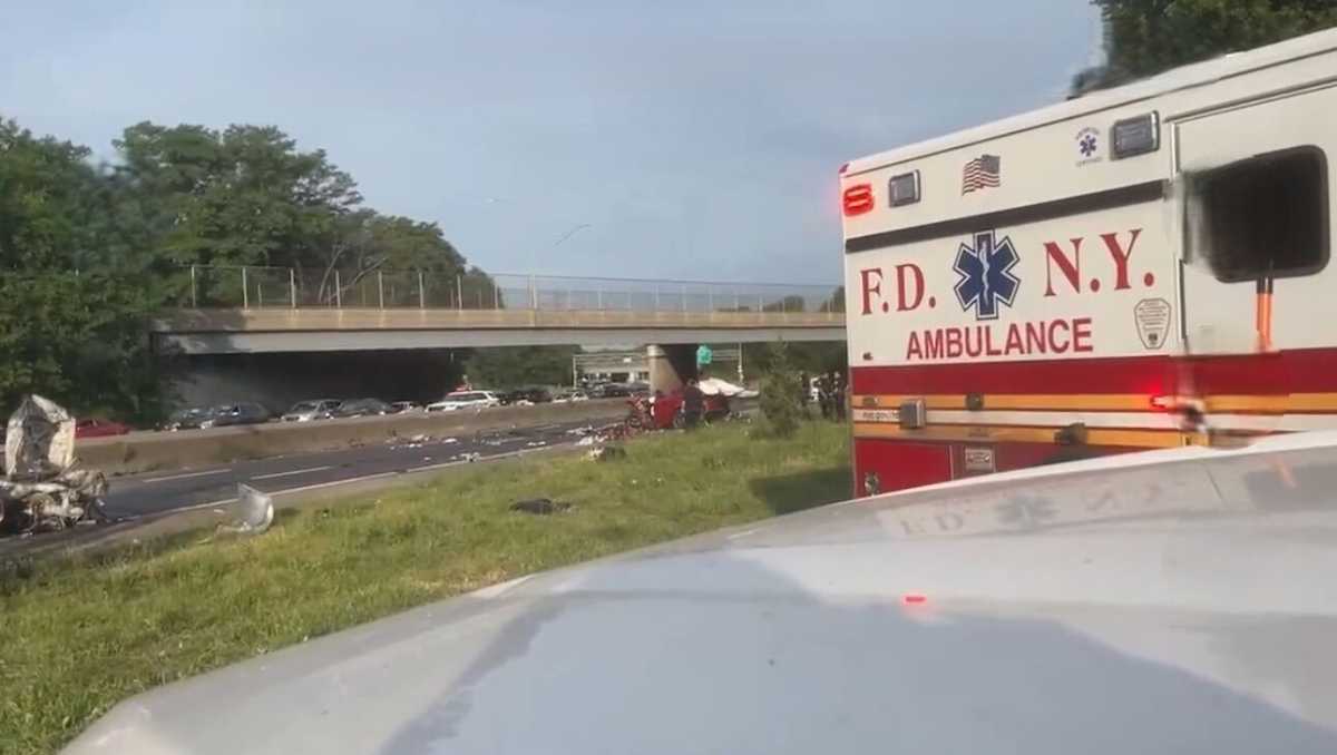
RentHop, a site that sorts apartment and home listings, conducted a study to bring awareness to traffic fatalities across the five boroughs of New York City after the U.S. was the only country to refuse to sign the Stockholm Declaration, an agreement pledging to eliminate traffic deaths by 2050, in February.
Researchers analyzed 2019 motor vehicle collisions data made public by the NYC Open Data Portal and ranked neighborhoods according to their geolocation.
The major patterns that the RentHop researchers came across showed that the number of traffic fatalities rose by 30% in Manhattan in 2019. Brooklyn traffic fatalities increased by 24% and the number of persons killed in motor vehicle crashes went from 62 in 2018 to 77 in 2019, making Brooklyn the borough with the most casualties.
The Upper West Side is considered one of the safest neighborhoods, but experienced three deaths in 2019. Overall traffic fatalities dipped in Queens, but some neighborhoods saw more deaths, with the total persons killed in South Ozone Park rising from two to seven in 2019.
In Annadale-Huguenot-Prince’s Bay-Eltingville, Staten Island, the death toll rose from zero to three in 2019 even though the number of collisions went down by 47%. Similarly, the number of collisions decreased in Mount Hope, the Bronx, but the neighborhood saw three traffic deaths in 2019.
RentHop found that more traffic collisions occurred in the afternoon between 12–5 p.m. than any other part of the day. There also tends to be more vehicle collisions in June and July than in other months.
Midtown-Midtown East tops all neighborhoods as the area with the most collisions per 10,000 people, with 3,808 collisions in 2019. While the number of collisions did go down by 13%, three people were killed in the car crashes.
RentHop also found that because the City of New York, the city center and parts of Brooklyn are more crowded due to economic activities, there are more collisions.
RentHop hopes that their data-driven approach to collisions and traffic fatalities will help renters and homebuyers identify potential safety issues they might face in their neighborhood, as well as also generate awareness on traffic deaths.
“After all, each data point we included in this study represents one life, and that could be our coworkers, friends, or family,” according to the study.
The full report can be found at www.renthop.com.