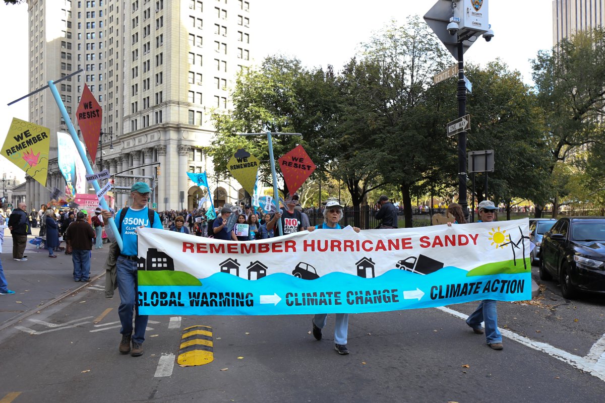
Hundreds marched over the Brooklyn Bridge into Lower Manhattan on Saturday to mark the fifth anniversary of Hurricane Sandy with a call for action against climate change, which studies show has made Downtown even more vulnerable to catastrophic storms.
BY COLIN MIXSON
Five years after Hurricane Sandy inundated Lower Manhattan with intense tidal surges and torrential rain, Downtowners are at as great a risk of flooding as ever, according to one local civic honcho.
“Not one person has confidence that our neighborhood is protected in the event of a Sandy-level storm based on what the city had done,” said Catherine McVay Hughes, a board member with the Battery Park City Authority and former chairwoman of Community Board 1.
In New York City, major floods have become dramatically more common since the Industrial Revolution, and storms that would have occurred once every 500 years will become five-year events within the next three decades, according to a recent study authored by researchers from top schools throughout the country, including Princeton University and Massachusetts Institute of Technology.
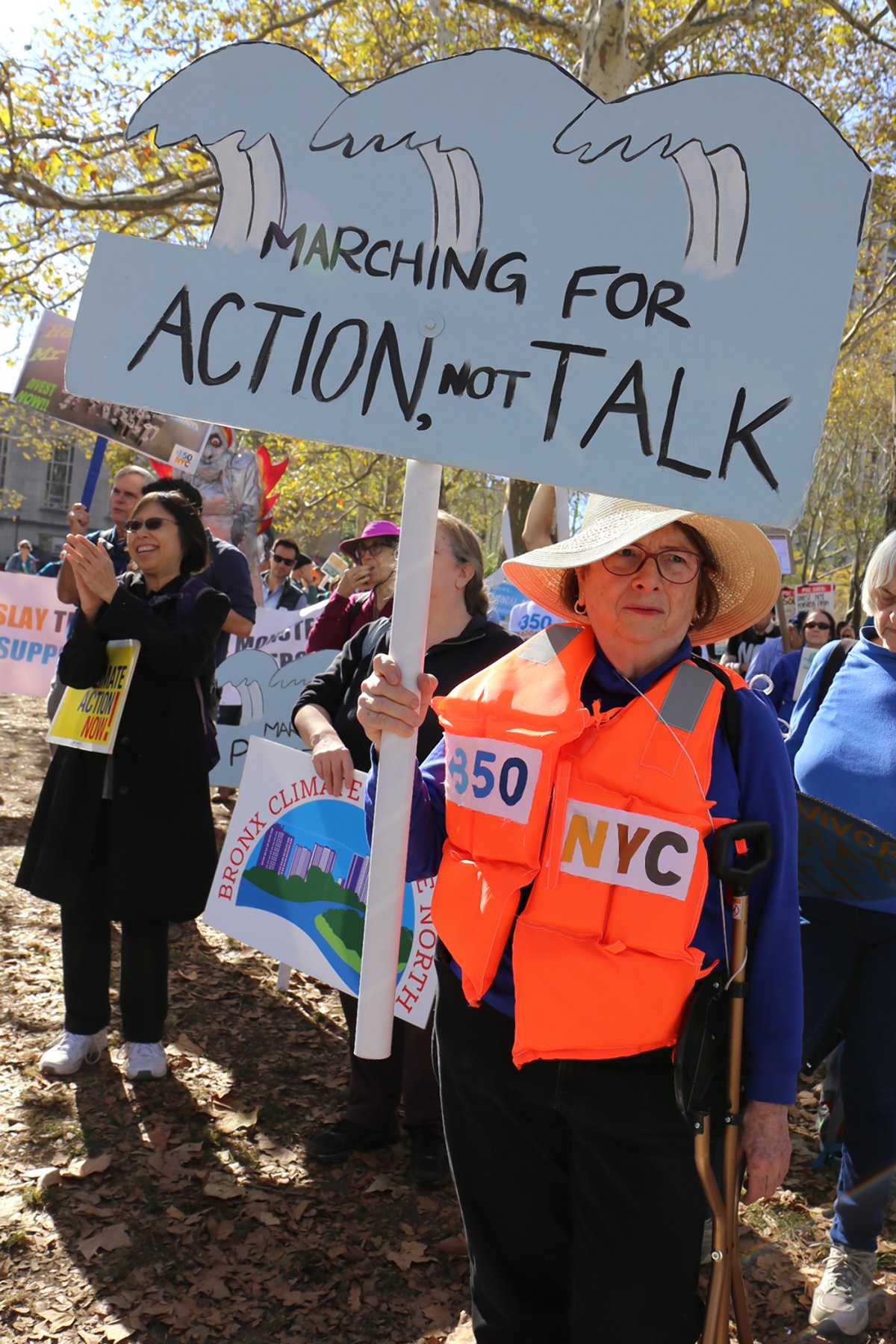
The study discovered that rising seas coupled with sinking landmasses around the five boroughs have left the city more vulnerable than ever before to relatively weak storms that in ages past would have merited little concern, according to one researcher.
“A storm like Sandy, which 150 years would not have flooded Lower Manhattan, did in fact flood it, and a somewhat weaker storm 100 years from now could easily flood the city to the same extent,” said Kerry Emanuel, a professor at MIT. “It’s all about sea-level rise.”
Emanuel hopes that the study will help the city understand the rising threat, and lead to infrastructure improvements both large and small to help mitigate future flood damage.
“You can do anything from restructuring buildings to make them more waterproof, all the way up to building a storm barrier that could go from Long Island to New Jersey,” he explained.
And the city, along with service and utility providers like the MTA and Con Edison, has made small gains here and there, largely through efforts designed to ensure emergency services and hospitals stay up and running during major floods, and that subway tunnels and energy infrastructure aren’t corrupted by brackish water.
But major resiliency projects designed to prevent the deluge itself from flooding Lower Manhattan remain on the distant horizon, with efforts such as the Big U — a more-than-$1-billion system of levies and park land designed to stretch from E. 23th Street in Midtown all the around the Big Apple’s southern tip and up to Battery Park City — won’t even begin construction for more than a year.
And while workers are scheduled to start shoveling dirt sometime in 2019, they’ll be laboring over a project that isn’t fully funded, and locals can expect delays and even work stoppages if Uncle Sam doesn’t step in to foot the bill, according to the chairman of the City Council’s Committee on Resiliency.
“They say they’ll start construction in 2019, but once the funding runs dry, that’s it,” said Councilman Mark Treyger. “They don’t have all the funding in place.”
Adding insult to injury, officials have split the Big U into two smaller projects — the East Side Coastal Resiliency Project and the Lower Manhattan Resiliency Project — and a lack of funding for both phases of the levee system has led residents of different neighborhoods to compete for their slice of a dwindling pie, sometimes against the needs of their neighbors, according to Hughes.
“The funding and implementation of the Big U is has pitted various vulnerable communities against each other for limited resources,” she said.
Last estimates put the uptown-focused East River Coastal Resiliency Project — which stretches from E. 25th Street to Montgomery Street — over the top with $505 million in funding, but the Downtown resiliency project that covers the remaining two-mile gap still lacks tens of millions of dollars in funding, and the project will come to resemble less a U, and more a J unless the feds fill the gap, Treyger said.
“If you add up all these projects they have funding for it does not equal a Big U, it amounts to a Half J,” said Treyger.


