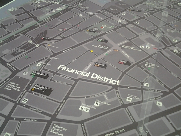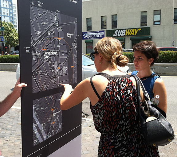

By KAITLYN MEADE | Heads up, Downtown, a new mapping system is on its way. New York City’s Department of Transportation is working on a “wayfinding” initiative to place pedestrian maps across the city, starting with Lower Manhattan.
Lower Manhattan is one of four areas in New York City that will receive the new maps, along with Midtown Manhattan, the Prospect Park area and Long Island City.
The first of the Downtown maps will roll out next month, say representatives from the D.O.T.’s contracted design group PentaCity, starting with seven signs along Canal St. In the following months, the maps will expand to Chinatown and then to Lower Manhattan.
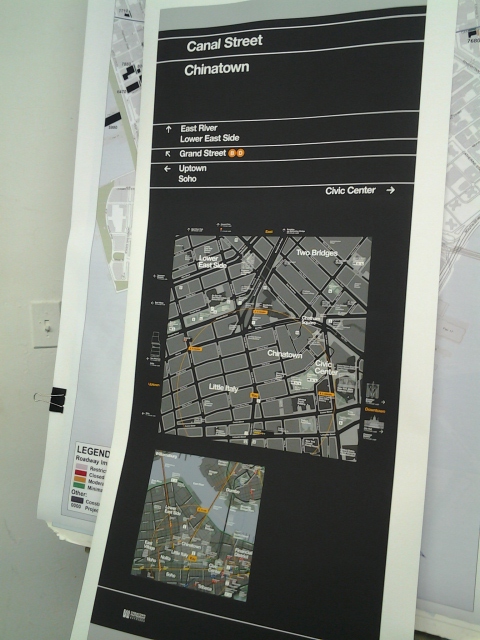
Community Board 1 has had several meetings with the D.O.T. to work on the maps’ content as well as their placement in the area.
“This was one of our big asks in our budget,” Catherine McVay Hughes, chairperson of C.B. 1, said at a March 6 meeting to discuss the signs’ content.
Downtown has a growing number of residents, employees and tourists who frequent the area. A comprehensive mapping system is intended to improve pedestrian traffic flow and invite more tourists to make a jaunt below Houston St.
The maps are on a sliding scale, from small “finger maps” and “path markers” which point the way to a specific landmark or periodically mark the path from one area to another. There are also medium-sized maps that will show landmarks, public amenities, tourist destinations, parks, subway stations and retail or dining corridors and neighborhood maps that show the whole of the area.
Individual businesses will not be shown on the map, however, because the priority is pedestrian navigation and extra clutter would make it too difficult to read.
At a C. B. 1 Planning Committee meeting in January, Wendy Feuer, the D.O.T.’s assistant commissioner of urban design and art, explained how to use the maps.
Based on European models, the D.O.T. has decided to use what’s called “heads-up” mapping, which is not based on a North-South axis but rather is positioned the way that the map-reader is already looking.
For pedestrians standing on Canal St. reading the map, facing southeast, the top of the map would also be southeast, showing the entrance to the Manhattan Bridge.
Although it may sound confusing, Feuer said it would be self-evident when reading the maps. In fact, field-testing of the maps showed that 80 percent of people interviewed preferred this type of pedestrian mapping as opposed to the more traditional North-South version, she reported.
The system will tie in both the M.T.A.’s subway map and the upcoming Citi Bike bikeshare program to make transportation citywide more accessible to residents and visitors alike.
While Citi Bike locations will not be shown on the pedestrian maps, the bike stations will have their own maps with similar branding showing station locations.
