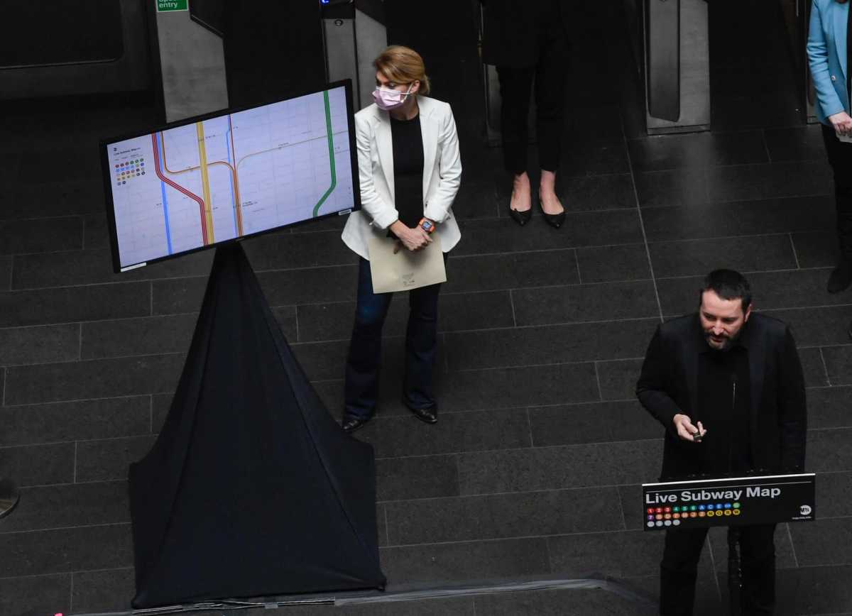
The Metropolitan Transportation Authority has released a new live, interactive map to – though only in the beta phase – to give commuters a more informed approach to planning their commutes.
While high-tech features are being deployed across the subways, buses and commuter lines such as the OMNY payment system at turnstiles, interim New York City Transit President Sarah Feinberg said in a Tuesday press conference that these continued efforts – while already in the works – will help coax riders back to mass transit after eight long months of pandemic.
“No longer will people have to decipher a range of in-station signs, you can plan your commute from the palm of your hand,” Feinberg said. “We want your thoughts and suggestion, as we continue to develop it we encourage riders to provide their feedback… We need to continue to do this kind of work to modernize mass transit in New York City. The MTA is the key to the regional economy and tools like this just make us better and make our riders ready to come back.”
According to Feinberg, contriving a rebound in ridership is still as relevant to the MTA’s struggles as their call for a $12 billion infusion of funds from the federal government through some form of stimulus, something that has been an unfulfilled request since they received $4 billion from the CARES Act in April.
Despite MTA coffers being dry as of the pandemic, when ridership numbers caved by over 90%, Chief Customer Officer Sarah Meyer said she has been leading a team, alongside private partners, over the last 18 months to develop the beta.
But it is not available in any app store, instead it is accessible through any browser through this link. According to Meyer, the next step will be to integrate the map in the MYmta app.
“We’ve merged features of the beloved Hertz and Vignelli maps in a way that can now show planned service changes holistically and accurately,” Meyer said.
According to the MTA, the development work was done pro bono by Work & Co.
The beta features of the map, as listed by the MTA, are as follows:
- Automatically updating train lines: Train lines will redraw themselves using real-time data to illustrate current and accurate train service status. Sections of train lines fade out where a train line is not running and are denoted with dashes if trains are running in a single direction.
- Moving trains: The user will see trains moving that help signal to users that the map is live and also reflect real-time locations of trains throughout the subway system.
- Zoom-In features: Greater map detail is exposed as the user zooms in, including the ability to see individual train lines, subway entrances, station names, and street locations and names.
- Subway accessibility: The new map highlights accessible stations and provides updates to accessibility-related equipment like elevators and escalators.
- Emergency alerts: The map uses the MTA’s data feed to convey official MTA communications for emergencies.
- Airports: The map visualizes both of NYC’s major airports and the primary means of accessing them via the MTA system. The map indicates which train lines connect with buses and the AirTrain to be able to access the airports. Users can tap or click on an airport to learn even more about how to access the airport using public transportation.
- Add to homescreen for quick reference: iPhone and Android users can add the map to their homescreen to access the map more quickly. The web-based map then behaves like a standalone app. Future integration with the MYmta app may be developed.
- Dynamic and shareable URL: The URL will store the location a user is looking at, the zoom level they are on, the train line they’ve filtered by, and whether or not accessibility mode is turned on. This allows users to share exactly what they are looking at with each other, or, to save or bookmark a unique URL based on their preferred train line.
